
Photo Agency - Astronomy - Space - Nature


> Earth from space gallerie
 |
 |
SlideShow Image 1605 / 2740 |  |
 |
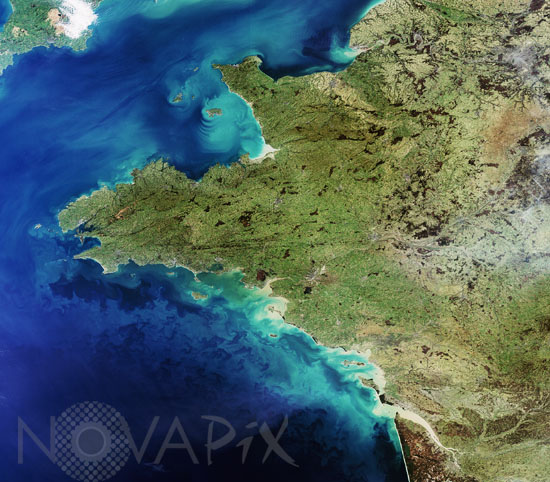
Western France as seen from satellite 2008
auteur: Esa/Novapix
référence: t-eufra-00024
Image Size 300 DPI: 19 * 17 cm
This Envisat image features western France, including the regions of Brittany, Western Loire, Normandy and Loire Valley, located in Western Europe. France's capital city Paris is visible as the gray area in the upper right hand corner. This image was acquired by Envisat's Medium Resolution Imaging Spectrometer (MERIS) instrument on 11 February 2008 working in Full Resolution mode to provide a spatial resolution of 300 metres.
Keywords for this photo:
2008 - ATLANTIC OCEAN - BRITTANY - CHANNEL - EARTH - EARTH FROM SPACE - ENVISAT - EUROPE - FRANCE - MERIS - OCEAN - SATELLITE IMAGE -
Contact : Stéphane Aubin +33-(0)9-51-26-53-76
© Novapix - All rights reserved