
Photo Agency - Astronomy - Space - Nature


> Earth from space gallerie
 |
 |
SlideShow Image 1564 / 2740 |  |
 |
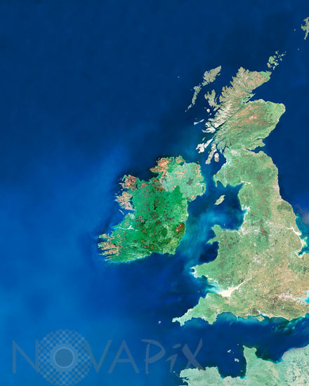
Ireland satellite view
auteur: ESA/Novapix
référence: t-euirl-00001
Image Size 300 DPI: 38 * 48 cm
This mosaic of MERIS (MEdium Resolution Imaging Spectrometer) images shows the country of Ireland (highlighted in dark green) and most of the island of Britain. The island of Ireland is the third-largest island in Europe. It lies on the west side of the Irish Sea and is composed of the Republic of Ireland in the south and Northern Ireland, a region of the United Kingdom. Also visible in the lower right cornerare the English channel and the coastline of Brittany, France. Envisat satellite.
Keywords for this photo:
EARTH - EARTH FROM SPACE - ENVISAT - EUROPE - IRELAND - ISLAND - MERIS - SATELLITE IMAGE -
Contact : Stéphane Aubin +33-(0)9-51-26-53-76
© Novapix - All rights reserved