
Photo Agency - Astronomy - Space - Nature


> Earth from space gallerie
 |
 |
SlideShow Image 1562 / 2740 |  |
 |
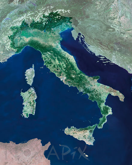
Italy seen from satellite
auteur: Esa/Novapix
référence: t-euita-00001
Image Size 300 DPI: 38 * 48 cm
This mosaic of MERIS (MEdium Resolution Imaging Spectrometer) images shows the country of Italy(highlighted in green). The Italian Republic is located in the south of Europe and consists mainly of a boot-shaped peninsula in the Mediterranean Sea,together with two large islands: Sicily and Sardinia, that divide the Mediterranean Sea into distinct bodies of water, such as the Adriatic Sea to the north-east, the Ionian Sea to the south-east, the Tyrrhenian Sea to the south-west and finally the Ligurian Sea to the north-west. It is bordered by the countries of France, Switzerland, Austria and Slovenia, the country is bounded by the Alps. Satellite Envisat
Keywords for this photo:
ADRIATIC SEA - EARTH - EARTH FROM SPACE - ENVISAT - EUROPE - ITALY - MEDITERRANEAN SEA - MERIS - SARDINIA - SATELLITE IMAGE - SEA - SICILY -
Contact : Stéphane Aubin +33-(0)9-51-26-53-76
© Novapix - All rights reserved