
Photo Agency - Astronomy - Space - Nature


> Earth from space gallerie
 |
 |
SlideShow Image 1472 / 2740 |  |
 |
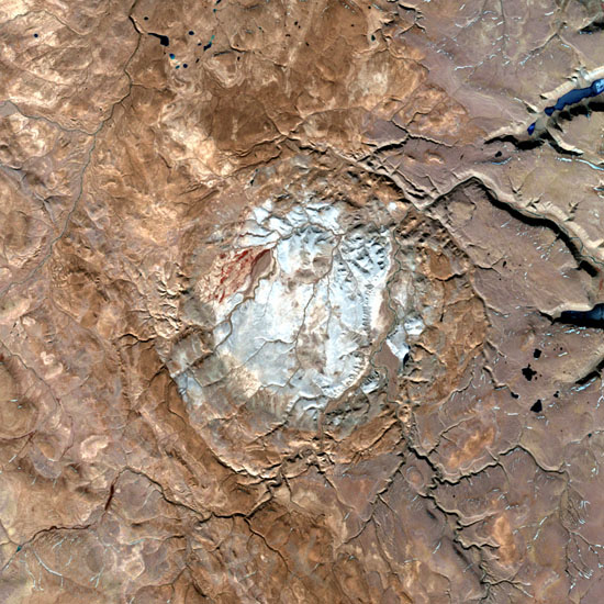
Haughton crater seen by satellite
auteur: Nasa/Novapix
référence: t-cra06-00500
Image Size 300 DPI: 8 * 8 cm
Haughton impact crater is located on Devon Island, in far northern Canada. It is about 23 kilometres (14 miles) in diameter and formed about 39 million years ago (late Eocene).The impacting object is estimated to have been approximately two kilometres in diameter. Devon Island itself is composed of Paleozoic shale and siltstone overlaying gneissic bedrock. When the crater formed, the shale and siltstone were peeled back to expose the basement; material from as deep as 1700 metres has been identified. At 75° north latitude, it is one of the highest-latitude impact craters known. Image taken by Landsat 7 satellite in 2000.
Keywords for this photo:
CANADA - EARTH - EARTH FROM SPACE - HAUGHTON - IMPACT - IMPACT CRATER - LANDSAT - LANDSAT-7 - SATELLITE IMAGE -
Contact : Stéphane Aubin +33-(0)9-51-26-53-76
© Novapix - All rights reserved