
Photo Agency - Astronomy - Space - Nature


> Earth from space gallerie
 |
 |
SlideShow Image 1426 / 2740 |  |
 |
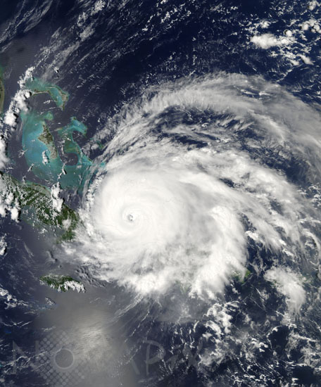
Hurricane Ike above Cuba
auteur: Nasa/GSFC/MODIS/Novapix
référence: t-nua01-00534
Image Size 300 DPI: 54 * 65 cm
Just an hour and a half after this image of Hurricane Ike was captured by the MODIS on NASA's Aqua satellite on September 7, 2008, the National Hurricane Center released its 2:00 p.m. EDT public advisory, warning residents of Cuba and other Caribbean islands, as well as the Florida Keys, that Ike was a dangerous Category 4 hurricane, with winds near 135 mph (215 kilometers per hour), with higher gusts. The image shows Ike approaching eastern Cuba, the eye just west of Great Inagua Island (one of the Turks and Caicos Islands). According to later advisories, Ike made landfall as a Category 3 storm, with winds around 125 miles per hour. Heavy rains were predicted to cause deadly floods and mudslides in mountainous parts of Hispaniola (Haiti and the Dominican Republic) and Cuba.
Contact : Stéphane Aubin +33-(0)9-51-26-53-76
© Novapix - All rights reserved