
Photo Agency - Astronomy - Space - Nature


> Earth from space gallerie
 |
 |
SlideShow Image 1395 / 2740 |  |
 |
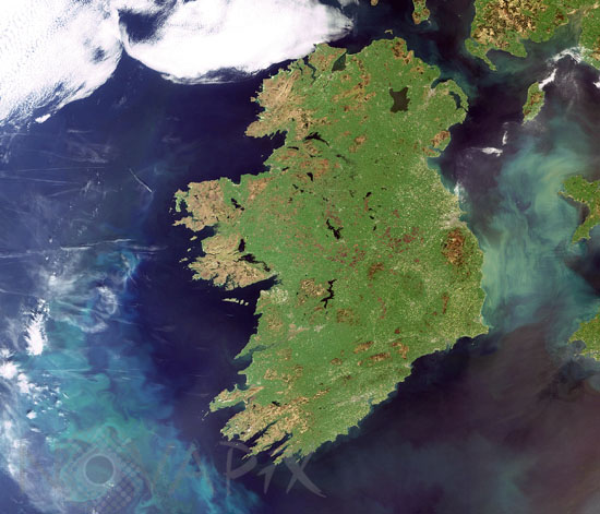
Ireland satellite view
auteur: ESA/Novapix
référence: t-euirl-00003
Image Size 300 DPI: 21 * 18 cm
This Envisat image shows the country of Ireland on 3 may 2007. The island of Ireland is the third-largest island in Europe. It lies on the west side of the Irish Sea and is composed of the Republic of Ireland in the south and Northern Ireland, a region of the United Kingdom.
Keywords for this photo:
2007 - EARTH - EARTH FROM SPACE - ENVISAT - EUROPE - IRELAND - ISLAND - MERIS - NORTHERN IRELAND - SATELLITE IMAGE -
Contact : Stéphane Aubin +33-(0)9-51-26-53-76
© Novapix - All rights reserved