
Photo Agency - Astronomy - Space - Nature


> Earth from space gallerie
 |
 |
SlideShow Image 1389 / 2740 |  |
 |
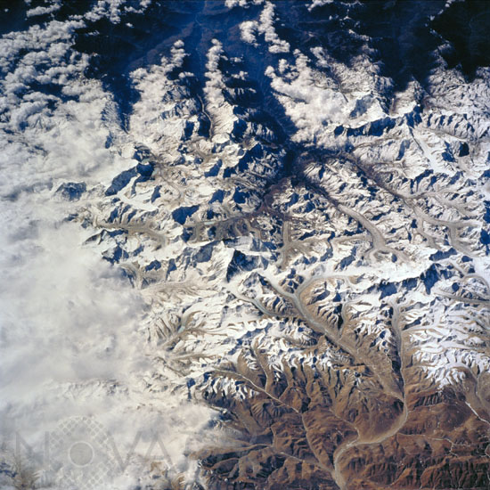
Mount Everest seen from space
auteur: Nasa/Novapix
référence: t-asnep-00009
Image Size 300 DPI: 34 * 34 cm
Mt. Everest (29,028 ft/8848 m; center of photo), also called Qomolangma Feng, is just north of the border between Nepal and China. The Himalayas and the Tibetan Plateau are products of the collision of the Indian and Eurasian tectonic plates. With the continuing northward march of India, the crust of the Earth has become thicker and the Tibetan Plateau has been uplifted to an average elevation of about 15,000 feet.
Image taken by astronauts in the space shuttle Endeavour in february 2000.
Image taken by astronauts in the space shuttle Endeavour in february 2000.
Keywords for this photo:
2000 - ASIA - EARTH - EARTH FROM SPACE - EVEREST - GLACIER - HIMALAYAS - MOUNT EVEREST - MOUNTAIN - NEPAL - SNOW - STS-99 - TIBET -
Contact : Stéphane Aubin +33-(0)9-51-26-53-76
© Novapix - All rights reserved